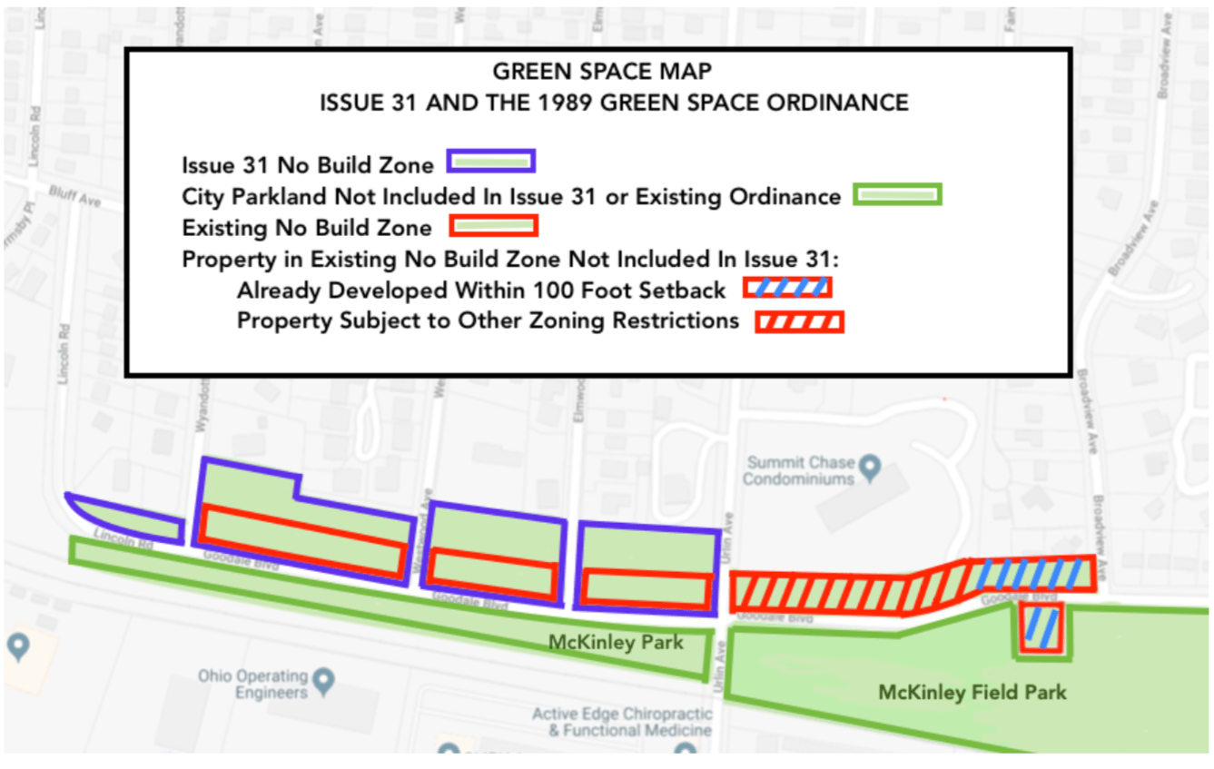
The Map above shows the Issue 31 “No Build Zone” and the 1989 Ordinance’s “No Build Zone.” Is there a material difference in the amount of area covered?
The Map identifies property included in the 1989 Ordinance that is already developed within the 100 foot No Build Zone. Issue 31 cleans up this error. Why include those properties or attempt to subject them to a zoning ordinance when the properties are already non-compliant? Yes, these homes existed when the 1989 Ordinance was enacted.
The Map also details other property included in the 1989 Ordinance that is not included in the Issue 31 definition of Green Space because these properties are already subject to other development restrictions and standards. Again, no need to include these properties in either the 1989 Ordinance or Issue 31.
Finally, the Map highlights the City’s Parkland South of Goodale that is not included in either the 1989 Ordinance or Issue 31.

Leave a comment